Dog-friendly fall leaf-peeping guide: Denver, Colorado
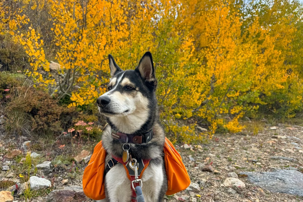
Seeing the seasonal transformation of aspen trees in the autumn is one of the most beautiful experiences in Colorado, and one we look forward to each year. There are several areas within 1-2 hours drive from Denver that make for perfect leaf-peeping day trips. Whether you’re after scenic driving, with sniff breaks for your pup, or dog-friendly hikes, you’ll find something perfect for your autumn magic vibes here!
This site contains affiliate links, which means when you click, we may receive a small commission from your purchase at no additional cost to you. This helps us run this page and offer great content free of charge, and we only recommend products that we use and love. We appreciate you!
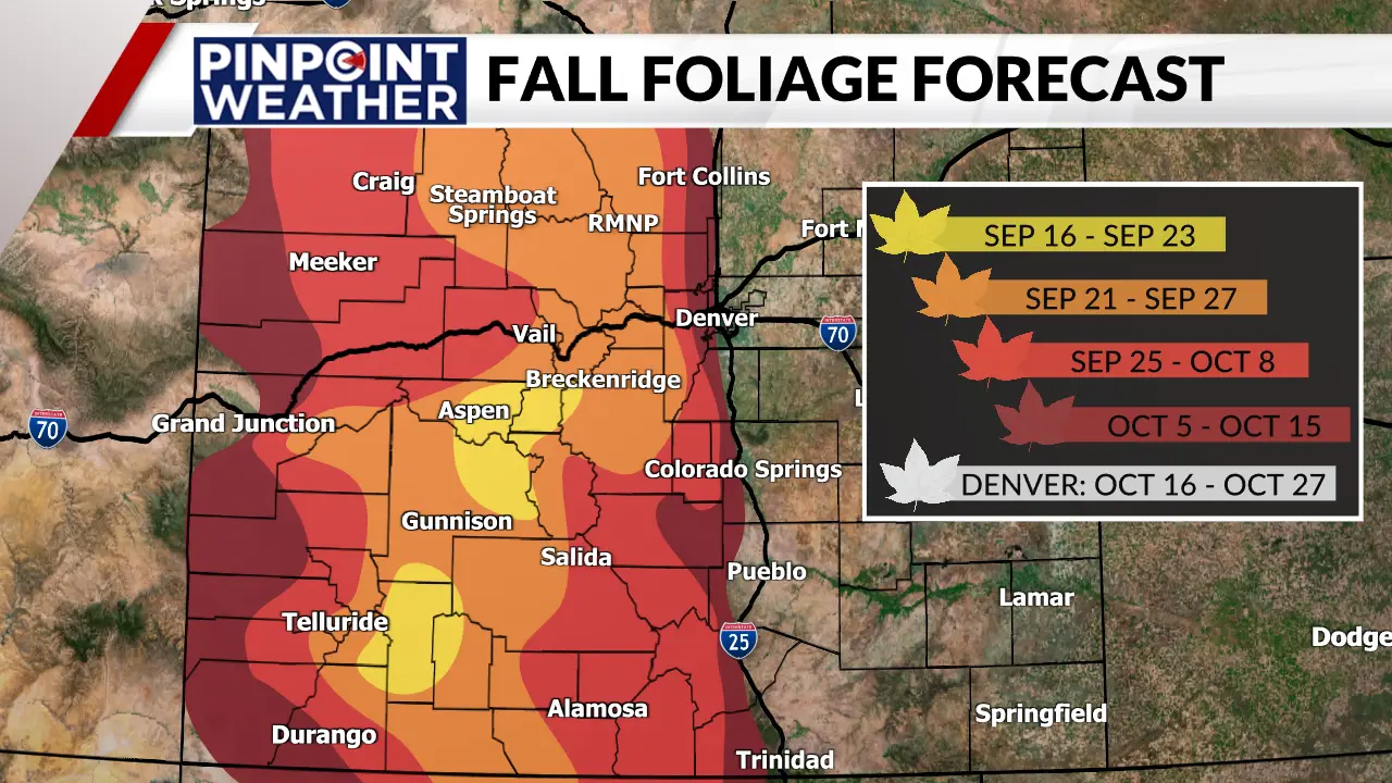
When planning day trips, we typically choose a general area, and then designate a scenic drive and a hike to explore. Thus, we’ve organized the information below according to general area, and you can mix & match according to your preferences.
Related Post: Hiking with your Dog: 12 Tips to Always be Pup-Pared
Complete Information about each hike listed below can be found by searching the following hike names on AllTrails. We highly recommend buying the pro version, as it will give you the most complete information, and allow you to download maps that will guide you when cell phone service is not available.
Nederland & Peak to Peak Highway

Nederland Area Scenic Drives
🚗Caribou Road – This is a gravel road starting in Nederland, and winding up to the remains of Caribou City Ghost Town. The road is a bit rough, but no 4×4 or high clearance needed. You’ll be treated to spectacular colors along the way. This pairs perfectly with the Caribou Hill Trail hike.
- To find this route: Enter “Nederland” as the beginning point into your GPS, and “Caribou Hill” as your ending point.
🚗Peak to Peak Scenic Byway between Nederland and Allenspark – This is a completely iconic paved road that takes you through endless scenery and gorgeous fall colors.
- To find this route: Enter “Nederland” as the beginning point into your GPS, and “Allenspark” as the ending point.
Nederland Area Hikes
- 🐾Caribou Hill Trail: Length: 3.3 mi, Elevation gain: 793 ft
- 🐾Long Lake via Hessie Trailhead: Length: 4.0 mi, Elevation gain: 830 ft
Silverthorne & Dillon

Silverthorn/Dillon Area Scenic Drives
🚗Highway 9 between Silverthorne & Heeney – This paved drive will take you along the edge of the Gore Range, and through swaths of fall colors. The Acorn Creek Loop and Lower Cataract Lake hikes are right off this road.
- To find this route: Enter “Silverthorne” as the beginning point into your GPS, and “Heeney” as the ending point.
Silverthorn/Dillon Area Hikes
- 🐾Lower Cataract Loop Trail: Length: 2.3 mi, Elevation gain: 223 ft
- 🐾Acorn Creek Loop Trail: Length: 4.7 mi, Elevation gain: 1,000 ft
- 🐾Old Dillon Reservoir Trail: Length: 1.7 mi, Elevation gain: 213 ft
- 🐾Salt Lick Trail: Length: 5.2 mi, Elevation gain: 944 ft
Breckenridge

Breckenridge Area Scenic Drives
🚗French Gulch Road – This road is mostly gravel, but no special vehicle is needed. It’s a bit off the beaten path, and you can find beautiful autumnal vibes along the way. The B&B to Reiling Dredge to Minnie Mine Loop Trail is right off this road.
- To find this route: Enter “Breckenridge” as the beginning point into your GPS, and “Black Gulch” as the ending point.
🚗Boreas Pass – A classic fall drive in the area, you’ll be amazed by sparkling golden leaves at every turn. This road is gravel, but no special vehicle is needed, just drive slowly. The “Bakers Tank Trail & Boreas Pass Road Loop”, and “Aspen Alley” trails are adjacent to this road.
- To find this route: Enter “Breckenridge” as the beginning point into your GPS, and “Black Powder Pass Trailhead” as the ending point.
🚗Highway 9 between Breckenridge & Fairplay – This paved, yet windey road is a lovely drive through various zones of scenery. The colors along this road pop early, and vividly!
- To find this route: Enter “Breckenridge” as the beginning point into your GPS, and “Fairplay” as the ending point.
Breckenridge Area Hikes
- 🐾Rainbow Lake via Peaks Trail: Length: 1.5 mi, Elevation gain: 167 ft
- 🐾B&B to Reiling Dredge to Minnie Mine Trail: Length: 2.6 mi, Elevation gain: 383 ft
- 🐾Aspen Alley: Length: 2.6 mi, Elevation gain: 528 ft
- 🐾Bakers Tank Trail & Boreas Pass Road Loop: Length: 2.6 mi, Elevation gain: 357 ft
Georgetown & Guanella Pass
Georgetown Area Scenic Drives
🚗Guanella Pass Scenic Byway between Georgetown & Guanella Pass Summit – One of the iconic places to see color, you won’t be alone, but you’ll be so immersed in beauty you won’t care. The “Silverdale Heritage Trail” is right off this paved road.
- To find this route: Enter “Georgetown” as the beginning point into your GPS, and “Guanella Pass” as the ending point.
Georgetown Area Hikes
- 🐾Pavilion Point Via Argentine Central Railroad Grade: Length: 5.6 mi, Elevation gain: 997 ft
- 🐾Chicago Road Trail: Length: 1.8 mi, Elevation gain: 859 ft
Conifer, Bailey, & Kenosha Pass

Kenosha Pass Area Scenic Drives
🚗Guanella Pass Scenic Byway between Jefferson & Guanella Pass Summit – One of the iconic places to see color, you won’t be alone, but you’ll be so immersed in beauty you won’t care. The “Abyss Trail” is right off this paved road.
- To find this route: Enter “Jefferson” as the beginning point into your GPS, and “Guanella Pass Summit” as the ending point.
🚗Kenosha Pass between Bailey & Fairplay – This paved drive takes you through several small, colorful towns with tons of roadside stops of every flavor. As you climb up to the summit, you’ll see the most beautiful colors and stunning peaks. The Colorado Trail, right at the summit, is our favorite hike to explore the fall colors.
- To find this route: Enter “Denver” as the beginning point into your GPS, and “Kenosha Pass Summit” or “Colorado Trail Section #6 Trailhead”as the ending point.
Kenosha Pass Area Hikes
- 🐾Kenosha Pass North Trail: Length: 11.5 mi, Elevation gain: 1,666 ft (Note: This trail is rated difficult, but doing only a couple miles on it is plenty to see the magic)
- 🐾Abyss Trail to Helms Lake: Length: 11.7 mi, Elevation gain: 2,404 ft (Note: This trail is rated difficult, but doing only a couple miles on it is plenty to see the magic)
Denver Metro Area

Denver Area Scenic Drives
🚗Peak to Peak Scenic Byway between Central City & Nederland – If you’re a fan of mining history, you’ll love this drive, dotted with ghost towns, cabin ruins, and fall foliage galore! Golden Gate Canyon State park is right off this paved route, and both hikes listed below are close by.
- To find this route: Enter “place” as the beginning point into your GPS, and “place” as the ending point.
🚗Golden Gate Canyon Road between Golden & Peak to Peak Scenic Byway – This road takes you up a gorgeous canyon, and through graves of beautiful golden aspens. Golden Gate Canyon State park is right off this paved route, and both hikes listed below are close by.
- To find this route: Enter “place” as the beginning point into your GPS, and “place” as the ending point.
Denver Area Hikes
- 🐾Raccoon Trail – Golden Gate Canyon State Park: Length: 2.6 mi, Elevation gain: 462 ft
- 🐾Black Bear and Horseshoe Trail Loop – Golden Gate Canyon State Park: Length: 4.6 mi, Elevation gain: 1,204 ft
- 🐾Apex & Enchanted Forest Loop Trail: Length: 3.7 mi, Elevation gain: 800 ft
